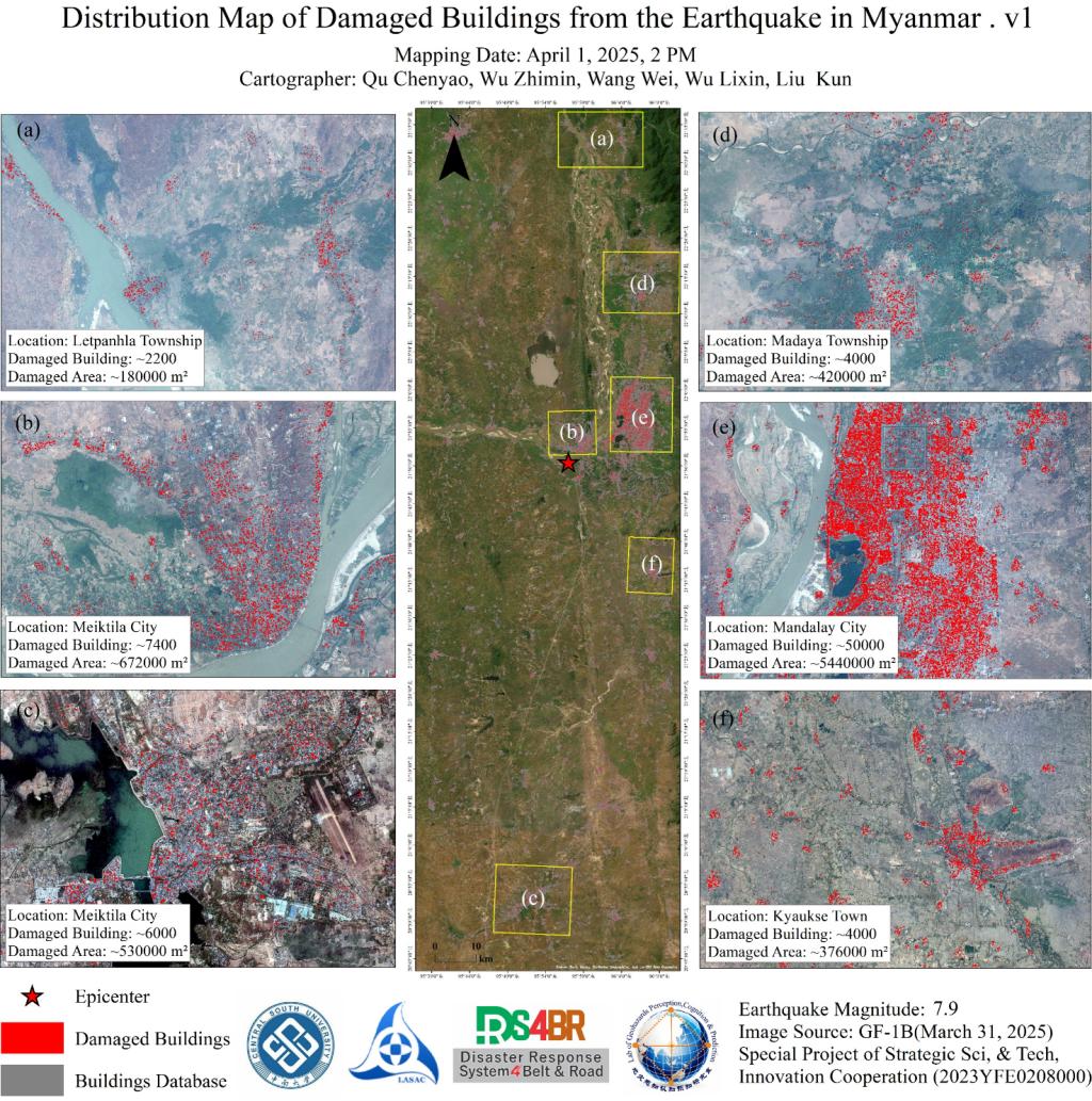
Leveraging GF-1B high-resolution satellite imagery (2-meter resolution) provided by the Land Satellite Remote Sensing ApplicationCenter,Ministry of Natural Resources of China, our team conducted a comprehensive damage assessment of buildings impacted by the March 28 Myanmar earthquake. The data revealed severe structural losses, with Mandalay Citysufferingthe most extensive damage—50,000 buildings destroyed or compromised, covering approximately 544,000 m2.Twozones in Meikhtila City reported significant destruction: 7,400 buildings (672,000 m2) and 6,000 buildings (530,000 m2). Additional damage was observed in LeipanhlaTownship(2,200 buildings/180,000 m2), MadayaTownship(4,000 buildings/420,000 m2), and KyauksTown(4,000 buildings/376,000 m2), cumulatively exceeding 2 million square meters ofaffectedareas.
Source:Disaster Risk Reduction Knowledge Service