标题:Punjab unveils flood relief package, but sets no timeline时间:2025-9-24 08:08:00正文:• Rs1m for destroyed, Rs500,000 for partially damaged houses• Farmers to receive Rs20,000 per acre of submerged land, Rs500,000 for each head of cattle lost• ‘Relief cards’ planned to avoid long queues at aid centres• Jalalpur residents say govt focused on saving motorway, neglecting villages• Do...
Details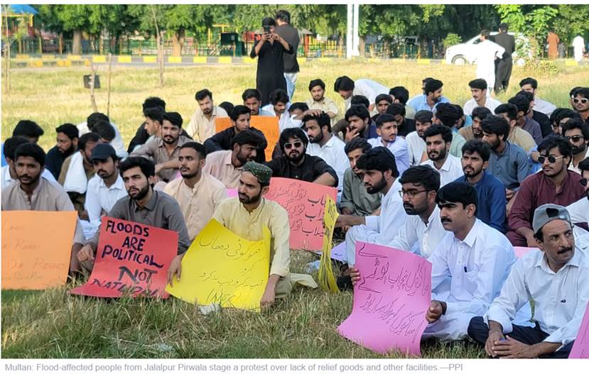
标题:All six M5 lanes washed away in new breach时间:2025-9-21 10:12:00正文:• Thousands of vehicles stranded, supply chains disrupted• Sutlej River forms 20-25km inland lake along Gilani Road-M5 stretch• Official admits controlled breach into Chenab might have reduced damage• One dead as boat capsizes in Muzaffargarh; three of a family drown in AlipurLAHORE: In a catastrophic escalation o...
Details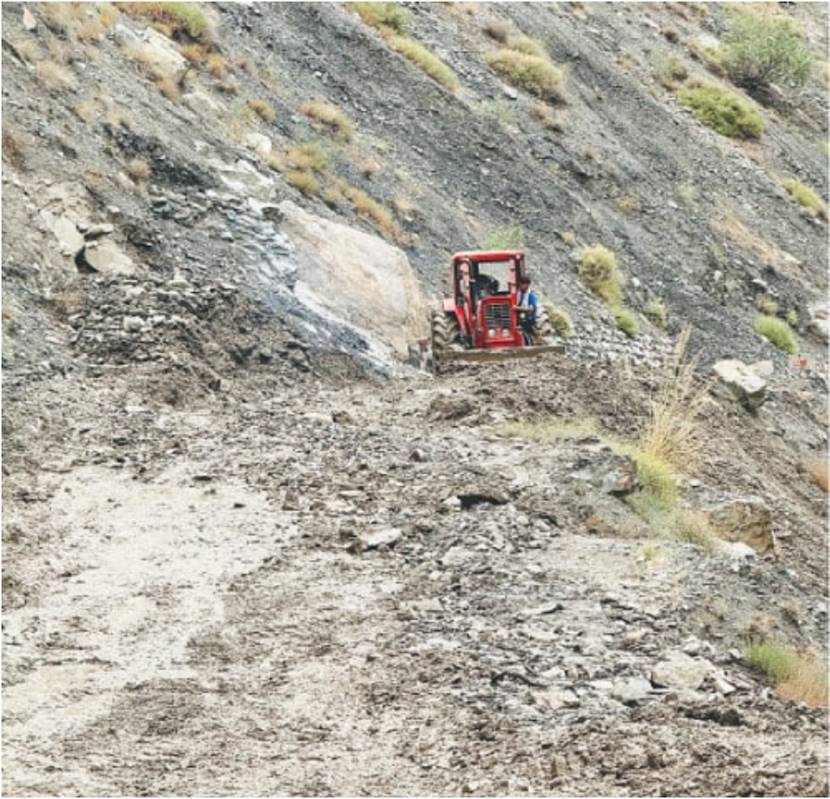
标题:Flash flood damages property, crops in Chitral时间:2025-9-19 11:17:00正文:CHITRAL: Heavy rain in the villages of Shali, Khora Lasht and Bilphok situated on the outskirt of Chitral city on Thursday triggered a flash flood, which damaged standing crops, gardens and property, while vehicular traffic remained suspended on Garam Chashma Road due to a landslide.Two vehicles were swept away in...
Details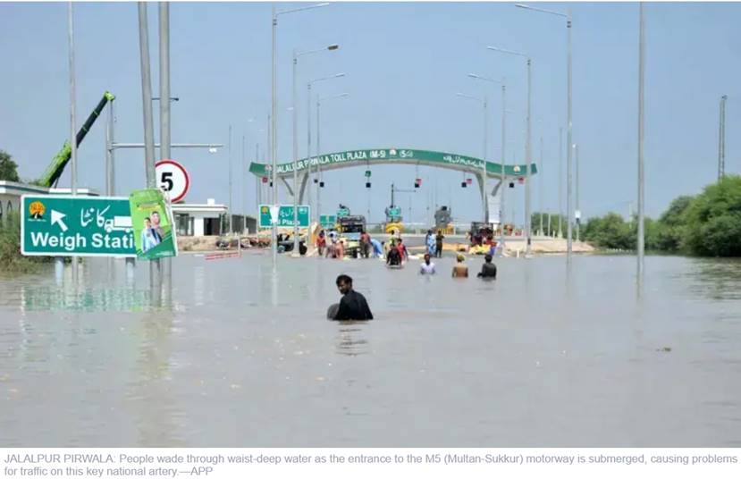
标题:Punjab heartland grapples with massive displacement时间:2025-9-16 07:39:00正文:• Overflowing rivers continue to inundate Multan, Bahawalpur, Lodhran, Muzaffargarh and Khanewal• Dozens of villages submerged; motorway, other thoroughfares blocked after controlled breaches fail to contain deluge• Water levels at Panjnad drop, but dykes still overflowing• PDMA issues alert for fresh spe...
Details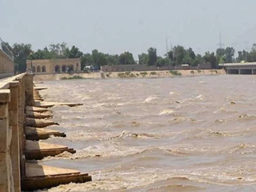
标题:Guddu Barrage records high flood as Indus River swells across Sindh时间:2025-9-14正文:Water levels in the Indus River rose to dangerous levels on Sunday as heavy flows from Punjab reached Sindh, triggering a high flood at Guddu Barrage.Guddu Barrage recorded an inflow of 612,269 cusecs and an outflow of 582,942 cusecs. Residents in low-lying areas were warned to move to safer locations....
Details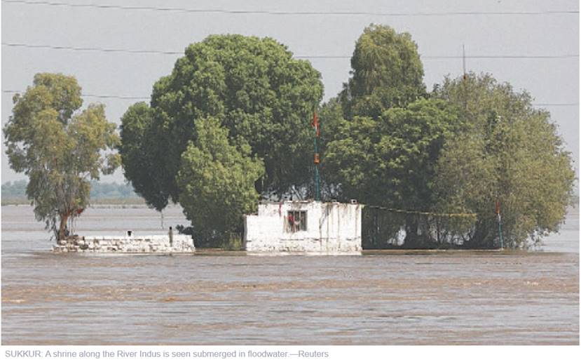
标题:Punjab rivers recede as flood enters Sindh时间:2025-9-15正文:The National Disaster Management Authority (NDMA) has issued new figures on river flows with rivers seeing decreased levels at different points in Punjab, while Sindh braces for higher levels.NDMA has also warned of the new monsoon spell clouding the upper regions of the country to hit by September 16.In the River Chenab, the ...
Details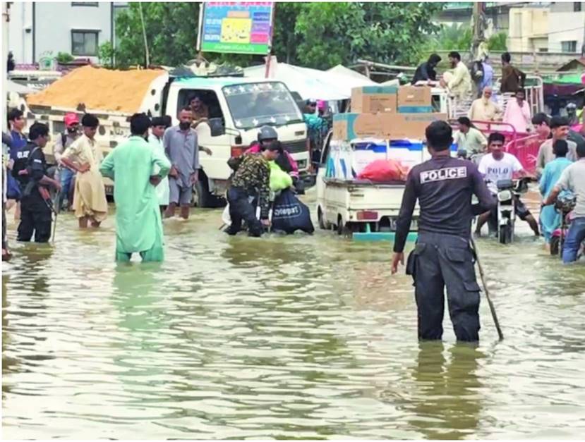
标题:Submerged and forgotten: Scheme 33 drowns in neglect时间:2025-9-12正文:KARACHI:The recent spell of monsoon rain and flash floods has left behind a trail of destruction in Karachi, with Scheme 33 and its adjoining residential societies submerged under floodwater. Despite the passing of several days, no drainage or relief operations have been initiated, leaving residents in a state of hel...
Details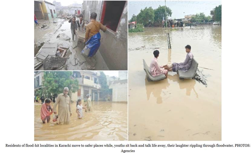
标题:Incessant rains trigger flood havoc in Karachi时间:2025-9-11正文:KARACHI:A sudden rise in water levels in the Lyari and Malir rivers flooded surrounding neighbourhoods, forcing many residents to evacuate their homes. Scores of families have temporarily relocated, while those who stayed behind are trying on their own to drain floodwater from their houses. Household belongings have been d...
Details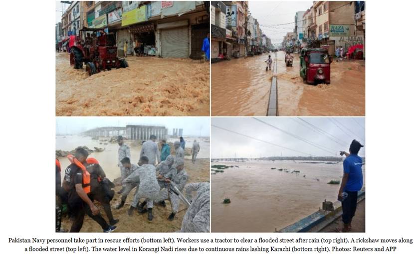
标题:Rescue efforts continue in Karachi as rains kill four, several missing时间:2025-9-10正文:KARACHI:Torrential rains paralysed Karachi on Wednesday, flooding neighbourhoods, sweeping away vehicles and leaving at least three people dead and several missing, as the army joined civil authorities in rescue operations.At least seven people were swept away when a rickshaw and two cars plunged in...
Details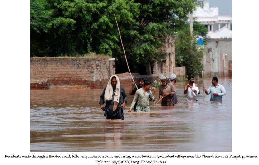
标题:At least 13 dead, over 4m affected as Punjab reels from severe floods时间:2025-9-9正文:At least 13 people, including five children, died as floods devastated Jalalpur Pirwala, where more than 50 villages have been badly affected by the Chenab and Sutlej rivers.Shops and houses collapsed, thousands of acres of crops were destroyed, and rescue teams struggled to reach stranded populations...
Details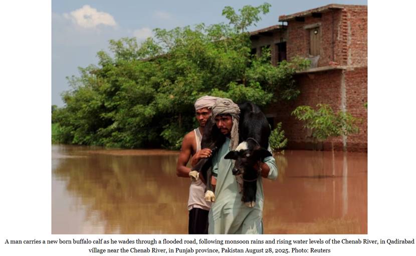
标题:Punjab flood crisis exacerbates with 10th monsoon wave时间:2025-9-8正文:With Pakistan now privy to new releases of water from India and the forecast of heavy rainfall in the upper catchments of Punjab, the Provincial Disaster Management Authorities (PDMA) have once again sounded the flood alarm. The 10th wave of monsoon rain is going to engulf the Punjab skies till September 9 with wate...
Details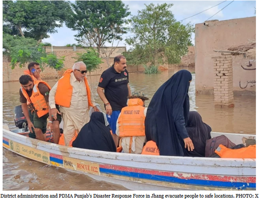
标题:Over 121,000 evacuated in Sindh as flood threat rises at major barrages时间:2025-9-6正文: At least five people, including a woman and four children, lost their lives after a boat carrying flood victims capsized during an evacuation operation in Jalalpur Pirwala on Saturday, officials confirmed.According to Rescue 1122, more than 20 people we...
Details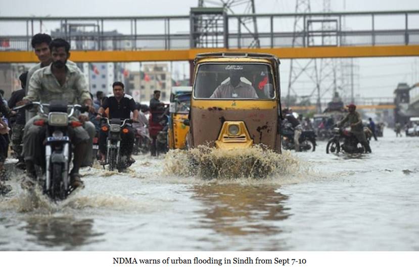
标题:NDMA warns of urban flooding in Sindh from Sept 7-10时间:2025-9-7正文:The National Disaster Management Authority (NDMA) has issued a weather alert warning of extremely heavy rainfall in parts of southeastern Sindh between September 7 and 10, raising concerns about urban flooding in low-lying coastal districts.According to NDMA, the anticipated downpour is linked to a weather system curr...
Details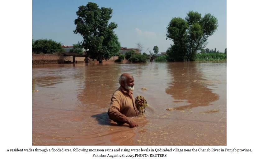
标题:Chenab, Sutlej flooding push provincial death toll to 68时间:2025-9-5正文:The flood crisis in south Punjab intensified on Friday as with rivers Chenab and Sutlej breaching embankments and submerging dozens of villages. This flood spell has claimed at least 68 lives across the province as per the Provincial Disaster Management Authority (PDMA) and left scores injured.River water from the...
Details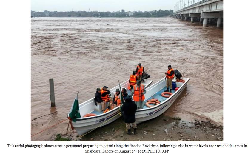
标题:Imminent flood threat eases as water levels stabilise, says PDMA时间:2025-9-4正文:At least 26 villages and 30,000 residents in Banda Malana, Banda Sandeela, Akbar Pura, Shershah, Gariwala and Mirza Pur remain at risk if embankments are breached.However, Provincial Disaster Management Authority (PDMA) Punjab spokesperson said on Thursday that water levels have stabilised for now, delayin...
Details
标题:Punjab floods ignite fears of Sindh deluge时间:2025-9-3正文:LAHORE:Floodwaters across Punjab reached alarming levels on Tuesday after India released additional discharges into the Sutlej and Ravi rivers, while persistent monsoon rains intensified the crisis, putting millions of lives at risk and raising fears of a super flood in Sindh.According to the Flood Forecasting Division (FFD), t...
Details
标题:Catastrophic rains, floods to trigger food shortages in Pakistan: UN时间:2025-9-2正文:KARACHI:The ongoing torrential rains and surging floods have inundated large swaths of farmlands and destroyed ready-to-reap crops across Pakistan, triggering fears of a food crisis and inflation, the UN and growers warned on Monday.The raging floods struck the northeastern Punjab, the country's larges...
Details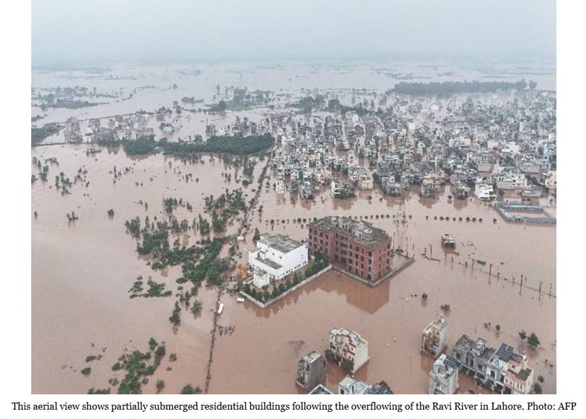
标题:Nation drowns in flood fury时间:2025-9-1正文:KARACHI/LAHORE/PESHAWAR:Year after year, during the monsoon season, the debilitating effects of global warming and the neighboring rival's water aggression become blatantly obvious. Yet even as multiple areas across the country face a high risk of destruction, it appears that the disaster prevention and calamity management authorities are sti...
Details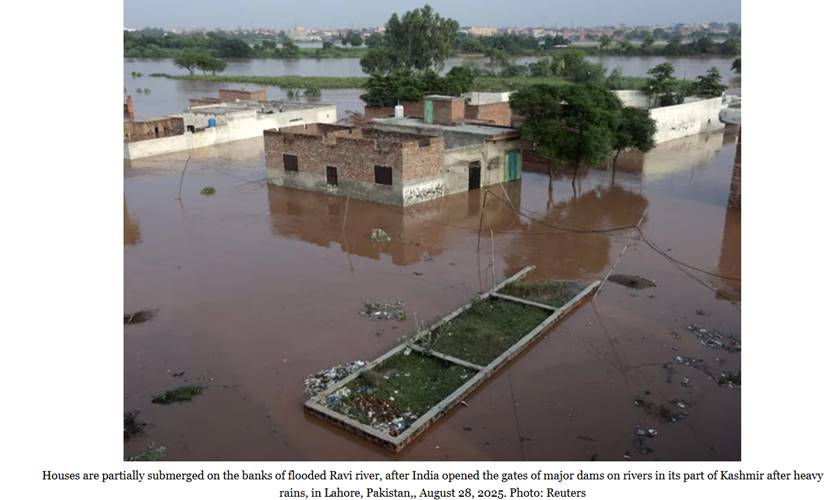
标题:Record floods displace millions in Punjab时间:2025-8-31正文:Punjab is facing one of the most severe flood emergencies in recent history as water levels continue to rise in the Chenab, Ravi and Sutlej rivers, displacing millions across the province.Punjab Provincial Disaster Management Authority (PDMA) Director General Irfan Ali Kathia warned that the situation could worsen within the ne...
Details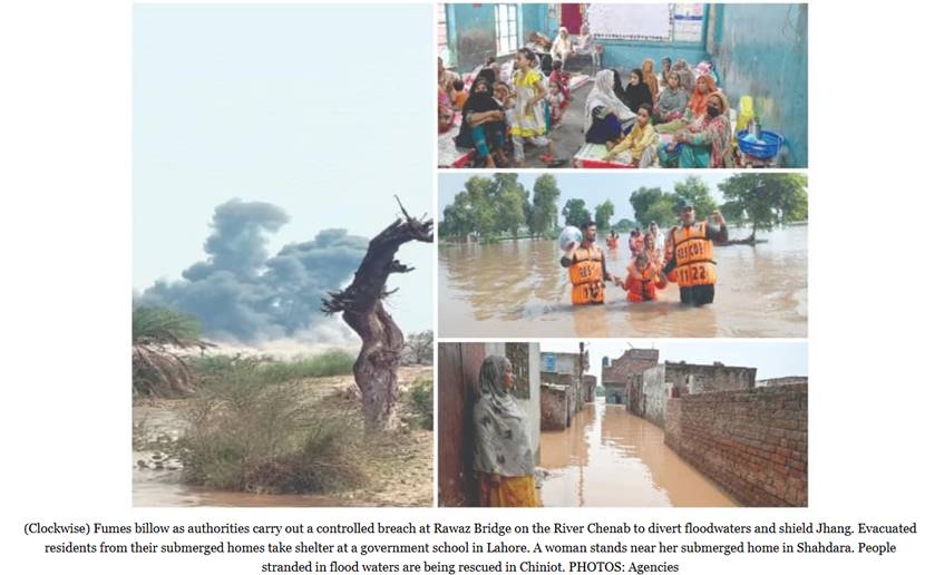
标题:Punjab floods impact 1.5m people as rescue, relief operations continue时间:2025-8-30正文:LAHORE:The Provincial Disaster Management Authority (PDMA) Punjab has issued its latest assessment of the devastation caused by the overflowing Ravi, Sutlej and Chenab rivers, outlining the scale of damage and the ongoing relief efforts.Relief Commissioner Nabeel Javed said more than 2,308 villages ...
DetailsCopyright © 2025. DRS4BR All rights reserved.