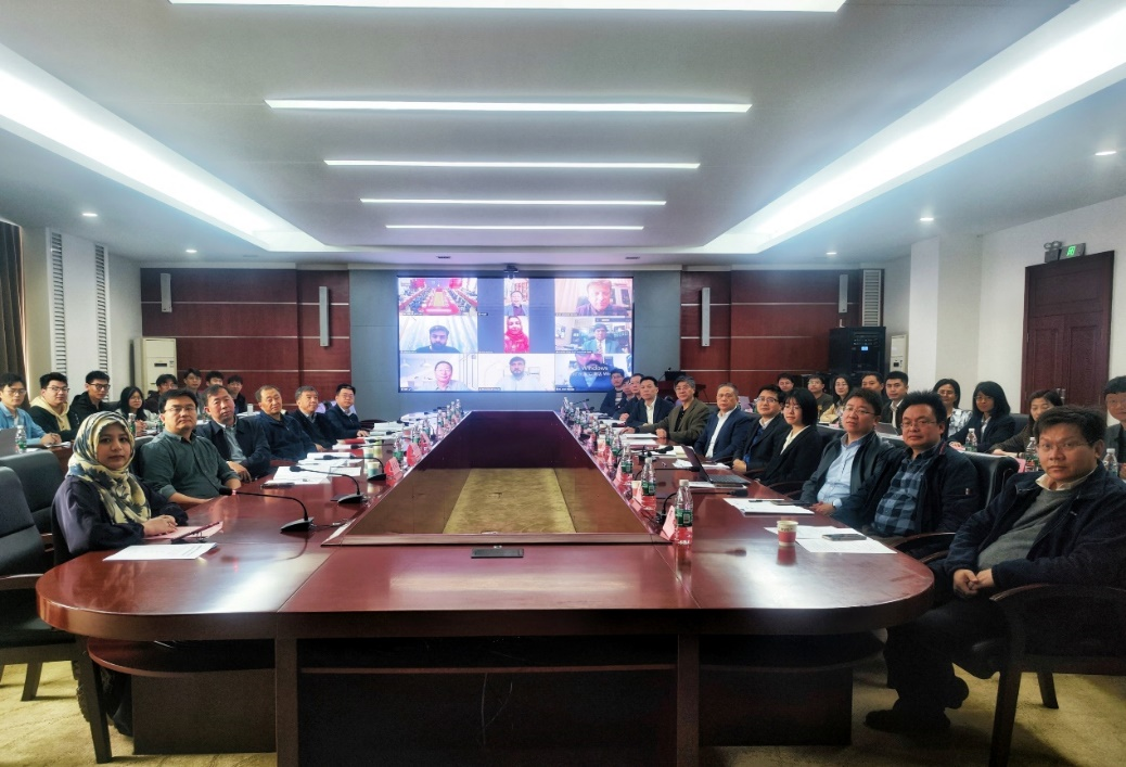
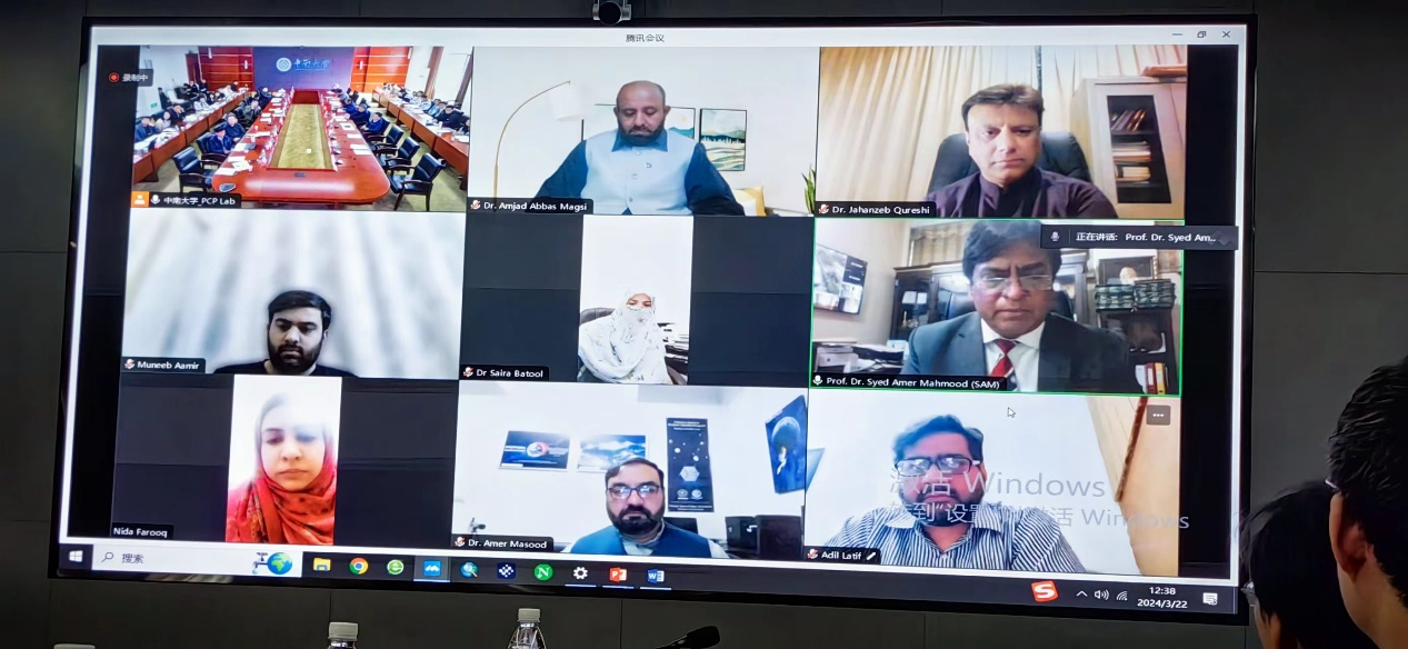
3月22日,由国际欧亚科学院院士、中南大学地球科学与信息物理学院吴立新教授作为项目负责人,中南大学牵头承担的“战略性科技创新合作”重点专项(第一批)《典型重大自然灾害卫星应急技术系统研制与应用示范》项目启动会在校本部科教楼三会议室召开。中南大学副校长郭学益教授、国际合作与交流处处长殷刚教授、校科研部副部长甘雪萍教授、巴方旁遮普大学校学术委员会主席Amjad Abbas Magsi教授、空间科学性系Syed Amer Mahmood教授及项目共同承担单位相关负责人等参加会议。
The launch meeting of the "Strategic Science and Technology Innovation Cooperation" key special project (the first batch) "Development and Application Demonstration of Satellite Emergency Technology System for Typical Major Natural Disasters" led by Central South University was held in the third conference room of the Science and Education Building of Central South University (CSU) on March 22nd, 2024. Professor Wu Lixin, an Academician of Eurasia Academy of Science, from the School of Geosciences and Info-Physics, Central South University serves as the project leader. Professor Guo Xueyi, Vice President of CSU, Professor Yin Gang, Director of the International Cooperation and Exchange Department of CSU, Professor Gan Xueping, Vice Director of the Research Department of CSU, Professor Amjad Abbas Magsi, Chairman of the Academic Committee of Punjab University in Pakistan, Professor Syed Amer Mahmood from the Department of Space Science of Punjab University, and relevant leaders of other project units attended the meeting.
项目由中南大学作为牵头承担单位,联合北京师范大学、电子科技大学、自然资源部国土卫星遥感应用中心、中国科学院地理科学与资源研究所四家单位集中攻关实施。项目设置了“灾害隐患遥感排查、风险识别与综合预判”、“灾害应急卫星聚焦监测与灾情关键要素快速提取”、“多模态应急数据快速汇集与灾损智能评估技术”、“重大灾害应急信息服务技术平台与应用示范”四个课题。
The project is led by CSU in collaboration with Beijing Normal University, University of Electronic Science and Technology of China, Land Satellite Remote Sensing Application Center of the Ministry of Natural Resources, and Institute of Geographic Sciences and Natural Resources Research, Chinese Academy of Sciences. The project has established four research topics, which are: "Remote sensing investigation of disaster vulnerabilities, risk identification, and comprehensive forecasting", "Emergency satellite focused monitoring of disasters and rapid extraction of key disaster elements", "Rapid collection of multimodal emergency data and intelligent assessment technology for disaster damage and loss", "Technical platform and application demonstration for major Disaster Reduction Services for the Belt-and-Road (DRS4BR)".
吴立新教授团队依托遥感科学国家重点实验室、时空信息与智能服务自然资源部重点实验室、国际减轻灾害风险合作研究中心等重要平台和UNESCO国际防灾减灾知识服务系统等国际网络,在灾害隐患排查、卫星应急观测、灾情快速识别、灾损精细评估、灾害知识服务和国际合作方面科研积淀丰厚。自2008年“汶川地震”以来,围绕重大自然灾害监测、灾情评估、应急服务等,自然形成的、具有长期合作基础的研究团队。团队在973、863、科技支撑和重点研发计划、国家自然科学基金、国家减灾委卫星减灾专项等项目和课题的资助下,在灾害科学研究与监测分析、空间信息应急服务技术等方面取得了系列成果(如震前遥感异常识别、滑坡与洪涝风险分析、InSAR形变解算云平台、UNESCO国际防灾减灾知识服务系统、众源数据清洗和汇集软件平台、森林和草原火灾风险预警监测系统)。
Prof. Wu Lixin's team, leveraging key platforms such as the State Key Laboratory of Remote Sensing Science, the Key Laboratory of Geospatial Information and Smart Service for Natural Resources of the Ministry of Natural Resources, and the International Research Center for Cooperation on Disaster Risk Reduction, as well as international networks like the Disaster Risk Reduction Knowledge Service (DRR) of International Knowledge Centre for Engineering Sciences and Technology (IKCEST) under the Auspices of UNESCO, has accumulated substantial research experience in the areas of disaster vulnerability investigation, satellite emergency observation, rapid disaster situation identification, precise disaster damage assessment, disaster knowledge service, and international cooperation. Since the "Wenchuan Earthquake" in 2008, a research team has naturally formed around the monitoring of major natural disasters, disaster assessment, and emergency service, which has a foundation of long-term collaboration. Under the funding of projects supported by the 973, 863, the Science and Technology Support Program, the Key Research and Development Plan, the National Natural Science Foundation of China, and the National Disaster Reduction Committee's satellite disaster reduction special projects, the team has achieved a lot in the areas of disaster science research and satellite monitoring analysis, as well as emergency service technology for spatial information (Such as the remote sensing identification of pre-earthquake anomalies, the risk analysis of landslide and flood, the InSAR deformation calculation cloud platform, the IKCEST-DRR under the Auspices of UNESCO, the crowd-sourced data cleaning and aggregation software platform, and the forest and grassland fire risk early warning monitoring system, etc.).
项目面向“一带一路”共建国家自主卫星资源缺乏、防灾减灾技术力量薄弱,在重大自然灾害面前被动应对、难以有效作为的现实难题,利用我国遥感卫星资源、发挥我国空间信息与防灾减灾技术力量,研制典型重大自然灾害卫星应急技术系统,开展国产卫星应急监测与应用示范,拓展区域性应急合作,为国际防灾减灾贡献中国智慧和中国方案。
本次项目启动会由中国工程院士、北京师范大学王桥教授,国际欧亚科学院院士、首都师范大学宫辉力教授,以及中国科学院空间中心申旭辉研究员、中科院武汉岩土所盛谦研究员、中科院/水利部成都山地研究所李爱农研究员、南京大学杜培军教授、中国自然资源航空物探遥感中心葛大庆教授级高工等业内顶尖专家组成专家组,对项目实施过程进行技术指导和专业支持。
Facing the lack of independent satellite resources and weak disaster prevention and mitigation technology in the "Belt and Road" co-construction countries, which make it difficult for them to respond passively and effectively in the face of major natural disasters. By utilizing China's remote sensing satellite resources and leveraging the country's strengths in spatial information and disaster prevention and mitigation technologies, the project aims to develop a satellite emergency technology system for typical major natural disasters. It will carry out emergency monitoring and application demonstrations using China satellites, expand regional natural disaster emergency cooperation, and contribute Chinese wisdom and solutions to international disaster prevention and mitigation.
A panel of top scientists and engineers in the field attended the launching meeting, including Prof. Wang Qiao from Beijing Normal University, who is an Academician of Chinese Academy of Engineering, Professor Gong Huili from Capital Normal University, who is an Academician of Eurasia Academy of Science, and Prof. Shen Xuhui from the Natioal Space Center, CAS, Prof. Sheng Qian from the Institute of Rock and Soil Mechanics, CAS, Prof. Li Ainong, from the Institute of Mountain Hazards and Environment, CAS, Prof. Du Peijun from Nanjing University, and Prof. Ge Daqing, a professor-level senior engineer from the Aeronautical Geophysical and Remote Sensing Center, Ministry of Natural Resources of China, who provided technical guidance and professional support.

王桥院士、宫辉力院士线上线下结合、共同主持了项目实施方案咨询会议。项目负责人吴立新教授和各课题负责人从立项背景、研究内容与实施方案、指标及预期成果、研发团队、工作基础和组织管理等方面详细汇报了项目整体情况。专家组肯定了实施方案与项目组前期工作,同意该项目尽快开展组织实施,并从关键技术突破、承研单位协同、应用示范落地等方面提出了宝贵意见与建议。
Prof. Wang Qiao and Prof. Gong co-chaired the consultation meeting on project implementation plan, combining both online and offline. Prof. Wu Lixin, the project leader, along with the leaders of each research topic, provided a detailed report on the overall situation of the project, covering aspects such as the background of the project initiation, research content and implementation plan, indicators and expected outcomes, the R&D team and their foundational work, and organizational management. The expert group affirmed the implementation plan and the preliminary work of the project team, agreeing that the project should proceed as soon as possible. They also offered valuable opinions and suggestions regarding key technological breakthroughs, collaboration among the institutions, and the practical application the project's outcomes and demonstration of the platform DRS4BR.