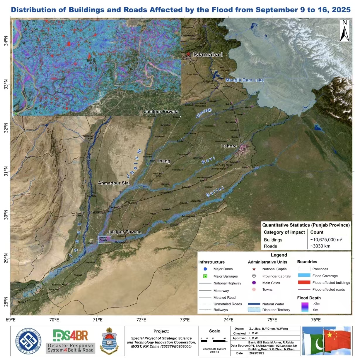
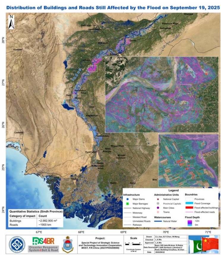
Based on multiple satellite observations on September 19, 2025 and before, we discovered the floodwaters in Sindh and Punjab are now primarily confined within the river/rivers channels, although a small portion of areas outside the channels are also inundated; and no short-term recession of the flood was currently observed. We estimated that in Sindh there are approximately 2,982,900 m² of building area remaining affected by the flooding water, and about 1,900 km of roads are still inundated; while in Punjab there are approximately 10,675,000 m² of building area remaining affected by the flooding water,and about 3,030 km of roads were still inundated. The most severely impacted region in Punjab was located at the confluence of the Jhelum and Sutlej rivers, where extensive villages and roads were submerged, particularly in Jalalpur Pirwala and its surrounding areas. Another area was Ahmadpur Sial and its vicinity, situated at the confluence of the Jhelum and Ravi rivers, which also experienced severe inundation.
In the DRS4BR system, the settlements were considered being affected if it was completely surrounded by floodwater with a water depth exceeding 0.2 m. According to the analysis, the overall flood depth was approximately 1 m, while depths within the main river channels exceeded 2 m, indicating that rescue operations should remain vigilant against strong currents in the affected regions.