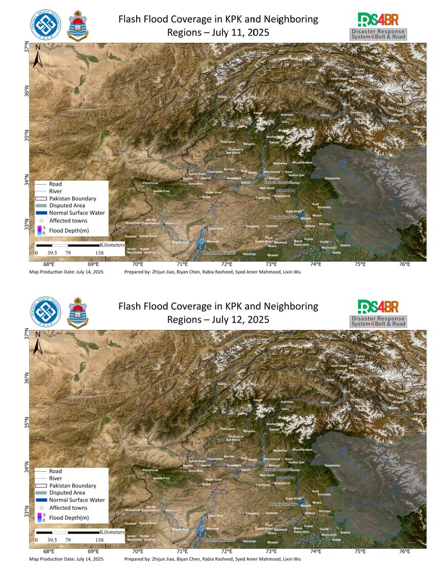
Using multi-source remote sensing data acquired from July 11 to 13, 2025—including Sentinel-2, Landsat-8, Landsat-9, and Sentinel-1—and applying the KDFIMv2 algorithm, floodwater depth retrieval has been completed for the affected regions. Results indicate minimal variation in floodwater depth around the Chashma and Tarbela Reservoirs, with no significant expansion of the inundated area. However, some low-lying regions show a gradual recession of floodwaters, although clear signs of drainage have yet to emerge.
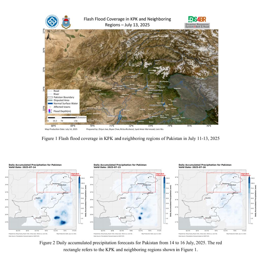
Precipitation forecasts indicate continued rainfall in the northern mountainous regions, ranging between 20–50 mm/day, which may pose localized flash flood risks. In addition, upstream inflow from these catchments could place increased pressure on reservoir drainage operations.
基于2025年7月11日至13日获取的Sentinel-2、Landsat-8、Landsat-9与Sentinel-1多源遥感数据,结合KDFIMv2算法,已完成对洪涝区域的水深反演分析。结果表明,Chashma与Tarbela水库周边地区的洪水水深整体变化不大,淹没范围未出现明显扩张;部分低洼区域的洪水水体则呈现缓慢回退趋势,但尚未观察到显著排水迹象。
未来几日,北部山区仍有20–50毫米/日的降水过程,需警惕局地性山洪风险。同时,流域来水可能加大水库的排水负担,应关注库区水位变化及其对下游排洪能力的潜在影响。