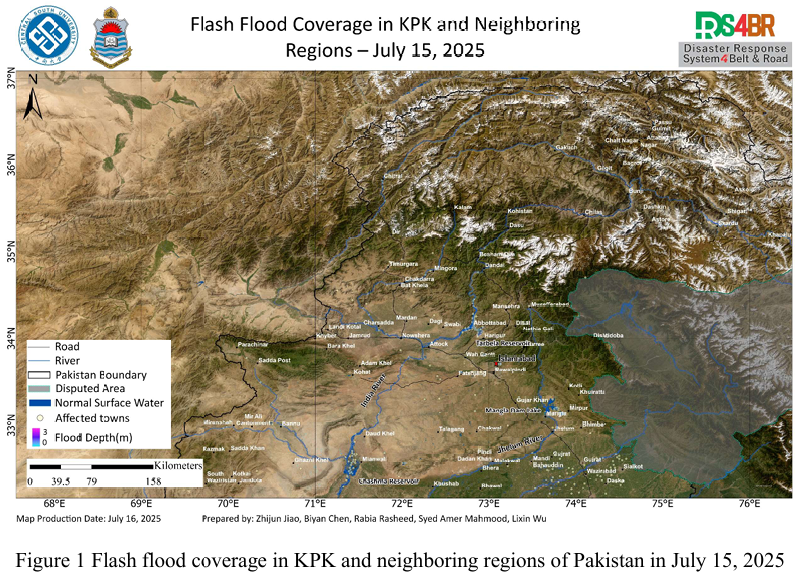
Using multi-source remote sensing data acquired from July 15, 2025—including Sentinel-2, Landsat-8, Landsat-9, and Sentinel-1—and applying the KDFIMv2 algorithm, floodwater depth retrieval has been completed for the affected regions. Results from Fig. 1 indicate that floodwaters around the Chashma Reservoir have largely receded, with only minor residual inundation remaining. The flooded area around Tarbela Reservoir remains stable, showing no signs of further expansion. Floodwaters around urban areas affected between July 11 and 14 have also gradually receded, indicating a potential shift toward post-flood recovery.
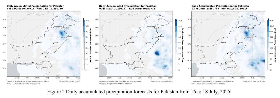
However, precipitation forecasts continue to show strong rainfall over parts of Punjab Province and the northern mountainous regions, with daily rainfall between 20 50 mm, as shown in Fig. 2. This poses ongoing risks of localized flash floods and may increase inflow pressure on upstream reservoirs, necessitating continued monitoring of reservoir levels and downstream discharge capacity.
基于2025年7月15日获取的Sentinel-2、Landsat-8、Landsat-9 与 Sentinel 1 多源遥感数据,结合KDFIMv2算法,已完成对洪涝区域的水深反演分析。图 1 中最新结果表明,Chashma 水库周边的洪水已基本退去,仅有少量残留水体; Tarbela 水库的扩张水域面积保持稳定,未见继续扩张趋势。此前在7月11日至 14 日期间受洪水影响的城镇,其周边洪水也逐渐退去,表明部分区域可能已进 入灾后恢复阶段。
未来几日,旁遮普省及北部山区仍将持续出现 20–50 毫米/日的降水过程, 需警惕局地性山洪风险(图 2)。同时,流域来水可能进一步加大水库的调度与排 水压力,建议持续关注库区水位及下游排洪能力变化。