Based on multi-source remote sensing data acquired on July 25–26, 2025 from Sentinel-1, Sentinel-2, Landsat-8, and Landsat-9, the KDFIMv2 algorithm was employed to perform the latest dynamic monitoring and integrated assessment of flood inundation extent and water depth across Pakistan.
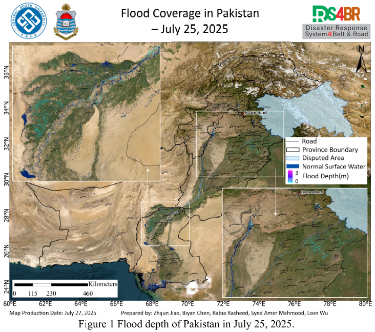
Fig.1 presents flood water depth estimates for July 25, 2025. The monitoring results indicate a gradual reduction in inundation depth and a contraction of the flooded area across Punjab and Sindh provinces. Water levels in the upstream region of the Chashma Reservoir and along the main channel of the Indus River remain under control, with no significant expansion of the inundated area observed.
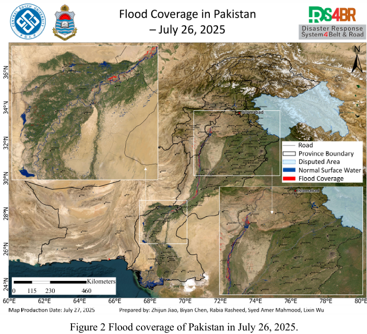
Fig.2 shows the inundation extent as of July 26. However, the dataset only covers parts of Sindh and Punjab provinces, primarily along the main course of the Indus River. The imagery indicates that water-covered areas have remained stable, with no further flood expansion.
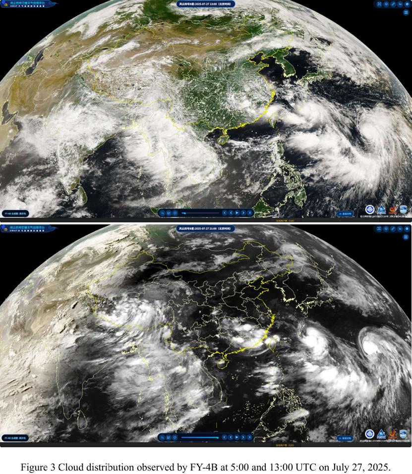
Fig.3 displays cloud cover derived from FY-4B geostationary meteorological satellite imagery between 09:00 and 13:00 UTC on July 27. Rapid cloud formation and expansion were observed along the Punjab–Sindh provincial boundary, suggesting rapid atmospheric changes.
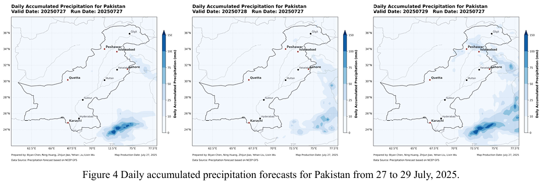
Despite this, the NCFP GFS global precipitation forecast model (Fig.4) indicates no significant precipitation across most of Pakistan in the coming days, except for light, localized rainfall in the northern mountainous regions (Khyber Pakhtunkhwa and Gilgit–Baltistan). However, in light of the cloud development observed in the FY-4B imagery, heightened vigilance is recommended in Sindh and Punjab provinces due to the potential risk of extreme weather events.
根据2025 年7月25日至26日获取的Sentinel-1、Sentinel-2、Landsat-8 与 Landsat-9 等多源遥感数据,采用KDFIMv2算法对巴基斯坦境内的洪水淹没范围与水深进行了最新动态监测与综合评估。
Fig.1 显示了2025年7月25日的洪水水深结果。监测表明,旁遮普省和信 德省的淹没深度均在逐渐降低,淹没范围也呈现收缩趋势。Chashma水库上游及印度河主干河道的水位处于可控状态,淹没范围较为稳定,无明显扩张迹象。
Fig.2 为 7 月 26 日的淹没分布结果,但数据仅覆盖信德省和旁遮普省部分 区域,主要集中在印度河主干河道。图像显示水域范围保持稳定,淹没未出现明 显扩展。
Fig.3 中FY-4B 静止气象卫星云图显示,7月27日9时至13时UTC,信德省与旁遮普省交界地带云团迅速聚集并扩张,天气变化较为迅速。
尽管如此,NCFP GFS全球降水预报模型(Fig.4)显示,未来几天巴基斯坦大部分地区无明显降水,只有北部山区(开伯尔-普赫图赫瓦省和吉尔吉特-巴尔 蒂斯坦地区)可能出现小范围降水。但结合FY-4B云图,信德和旁遮普省需对潜在的极端天气保持高度警惕。