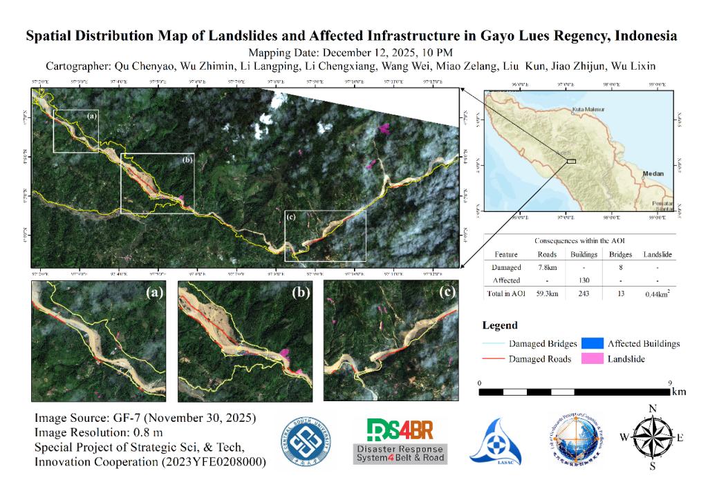
Following continuous heavy rains that began on November 22, 2025, flooding struck Indonesia's Gayo Lues Regency (approximately 4.067°–4.133° N, 97.025°–97.217° E). Utilizing remote sensing data captured on November 30 by the Gaofen-7 (GF-7) satellite, a disaster assessment was conducted through a combination of flood overlay analysis, deep learning-based landslide extraction, and manual visual interpretation. The resulting assessment reveals that the area suffered landslides covering approximately 0.44 square kilometers, with damage to 8 bridges and roughly 7.8 kilometers of roads, while more than 130 buildings were affected.