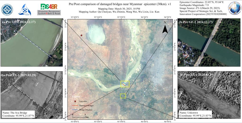
Utilizing ZY-1 high-resolution imagery (2- meter resolution) provided by the Land Satellite Remote Sensing Application Center, Ministry of Natural Resources of China, combined with advanced deep learning-based small target recognition algorithms, our team automated damage detection across bridge networks. Partial collapse of a kilometer-scale bridge (The Ava Bridge, coordinates 21.87° N, 95.99° E), where a fractured main span has obstructed river flow. Complete destruction of a 100-meter- scale unnamed bridge (coordinates 21.83° N, 95.99° E), rendering the structure impassable due to deck collapse.
Source: Disaster Risk Reduction Knowledge Service System