Topic 2, Subtopic 1, studies the disaster emergency satellite mission planning subsystem, as shown in Figure 1.
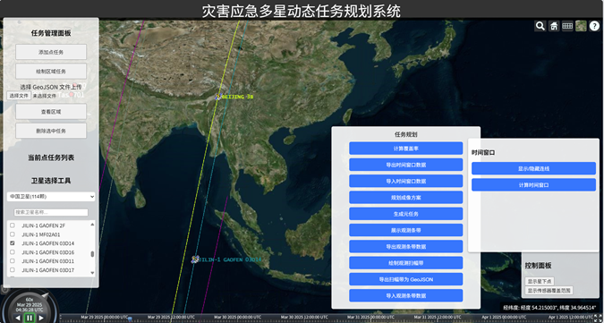
Figure 1. Interface of the Disaster Emergency Multi-Satellite Dynamic Task Planning System
At 14:20 on March 28, 2025, a magnitude 7.9 earthquake occurred in central Myanmar. After the project team initiated the emergency response, seismic parameters such as PGA released by the USGS were promptly obtained. Based on PGA and taking into account the pre-earthquake distribution of buildings, imaging targets for the emergency satellite mission planning were set ( Figure 2).
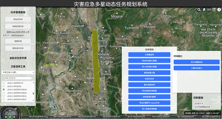
Figure 2. Defined Emergency Satellite Planning Area
In the disaster emergency mission planning system, different domestic satellites such as Beijing-3 and ZY1-02E were selected for coordinated satellite planning within three days after the earthquake. Planning schemes for various satellites from March 29 to March 31 were obtained (Figures 3–6).
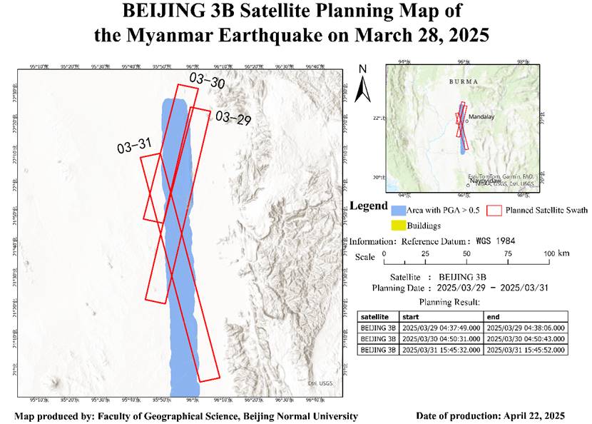
Figure 3. Beijing-3 Satellite Planning Map
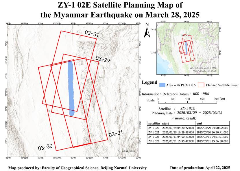
Figure 4. ZY1-02E Satellite Planning Map
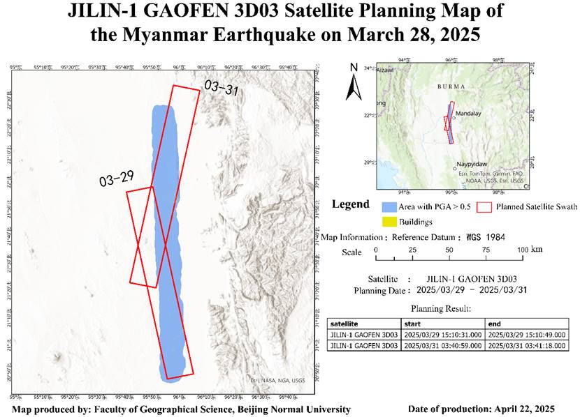
Figure 5. JILIN-1 GF 3D03 Satellite Planning Map
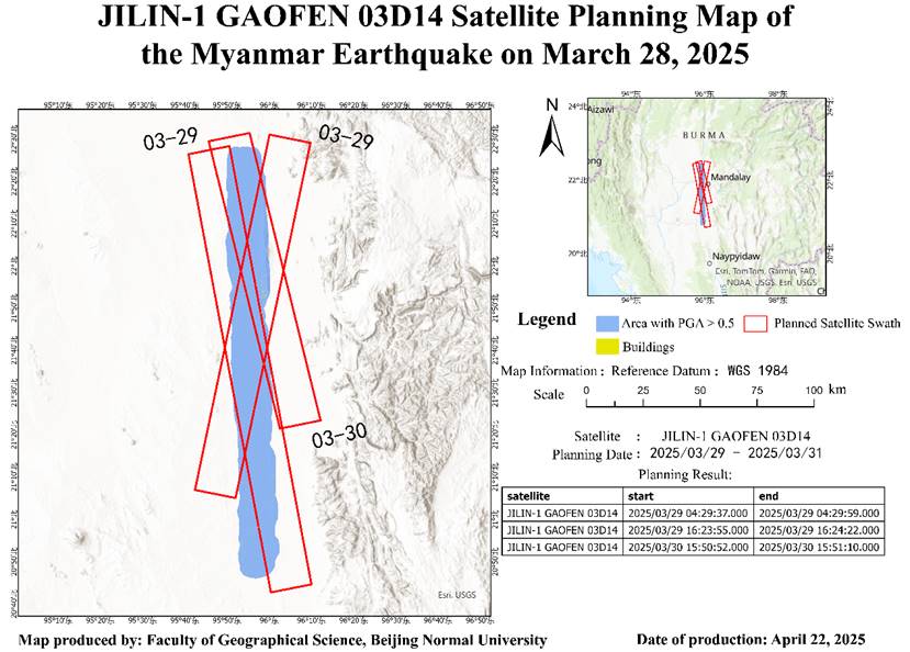
Figure 6. JILIN-1 GF 03D14 Satellite Planning Map
Finally, a comparison was made between the planning results of the project team’s system and the actual imaging coverage of ZY1-02E and Beijing-3 satellites (Figures 7 and 8). The results show that the planning scheme generated by the project team tends to cover a larger observation area and more potentially damaged buildings within that area. In actual imaging, the Beijing-3 satellite demonstrated greater flexibility, prioritizing the assessment of damage in urban areas with relatively lower seismic intensity.
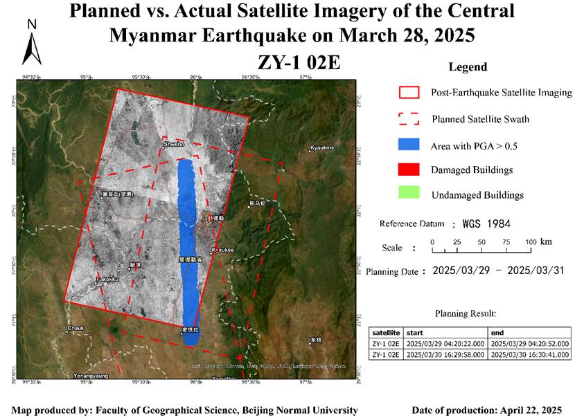
Figure 7. Comparison of Planned and Actual Imaging Coverage of ZY1-02E Satellite