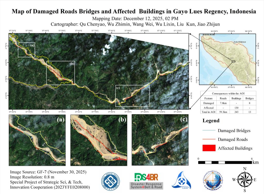
Following continuous heavy rainfall starting on November 22, 2025, flooding occurred in Gayo Lues Regency, Indonesia (approximately 4.067°–4.133° N, 97.025°–97.217° E). Based on remote sensing data acquired by the Gaofen-7 (GF-7) satellite on November 30, a preliminary assessment was conducted by overlaying flood inundation extents with building and road data, combined with manual visual interpretation, to generate a disaster assessment map. The results indicate that 8 bridges, approximately 7.8 km of roads, and over 130 buildings in the region were affected.