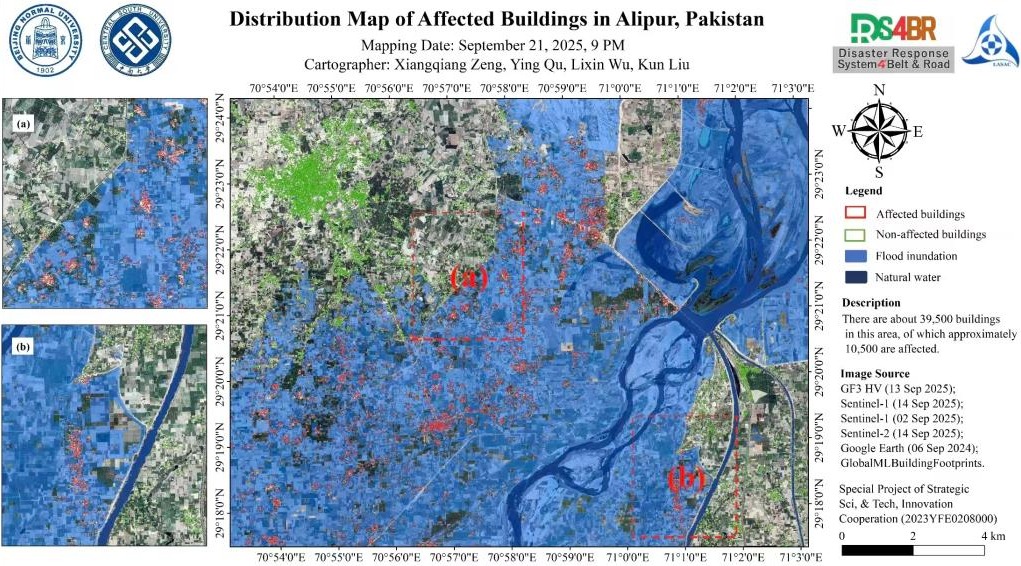
In early September 2025, Alipur District (approximately 29.3°N–29.4°N, 70.9°E–71.1°E) experienced severe flooding caused by intense rainfall and upstream inflows. Using available multiple satellite observations(Gaofen-3, Sentinel-1, Sentinel-2), we conducted a preliminary assessment based on flood inundation extent and building impact mapping. Results indicate that the district contains approximately 39,500 buildings, of which about 10,500 were affected. This assessment is derived solely from remote sensing data.