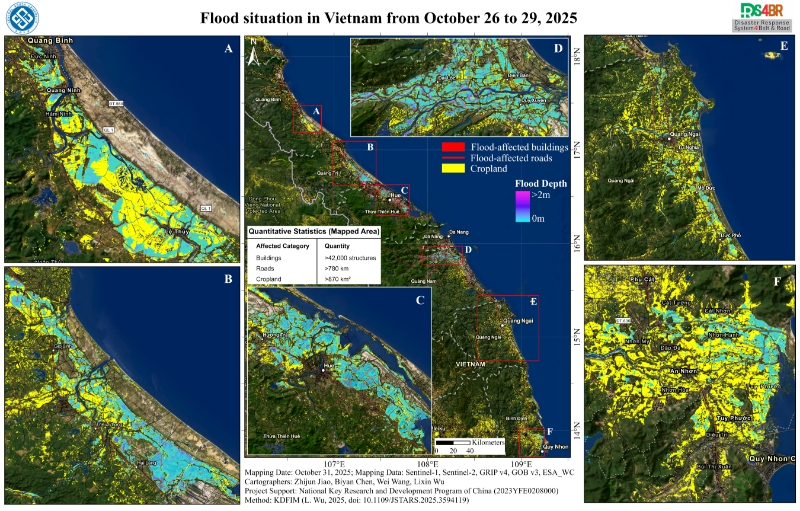
The research team led by Professor Lixin Wu, Academician of the International Eurasian Academy of Sciences and Head of the Remote Sensing Discipline at Central South University, conducted flood situation monitoring over Vietnam during October 26–29, 2025. Relying on the Disaster Response System for the Belt and Road (DRS4BR) and its Knowledge-Driven Flood Intelligent Monitoring (KDFIM) module, the team performed rapid flood assessment and analysis. The study integrated multi-source data, including Sentinel-1/2 imagery, the Global Roads Inventory Project v4 (GRIP v4), the Google Open Buildings Dataset v3 (GOB v3), and ESA WorldCover (ESA_WC).
The monitoring results revealed that the central coastal region of Vietnam was severely affected. Within the mapped area, more than 42,000 buildings were identified as impacted, approximately 780 km of roads were inundated, and over 870 km² of cropland was submerged. The most seriously affected zones, highlighted in the figure, include areas labeled B, C, and D, corresponding to Hue and its surrounding cities, where floodwater depths exceeded 1 m. Severe inundation of farmlands and road networks, along with extensive damage to residential and other built-up structures, was observed in these regions.