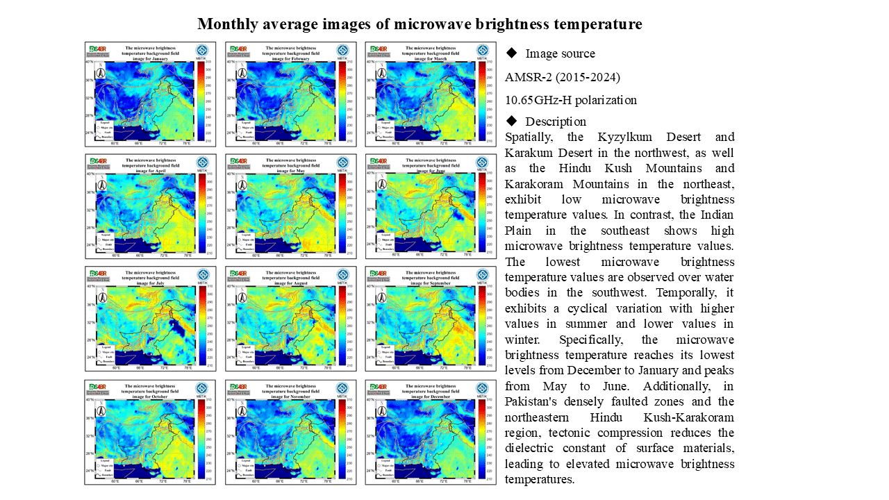
Monthly average images of microwave brightness temperatur
Details
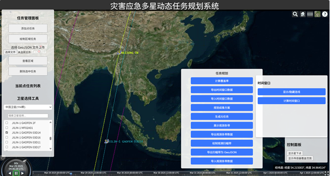
Topic 2, Subtopic 1, studies the disaster emergency satellite mission planning subsystem, as shown in Figure 1.Figure 1. Interface of the Disaster Emergency Multi-Satellite Dynamic Task Planning SystemAt 14:20 on March 28, 2025, a magnitude 7.9 earthquake occurred in central Myanmar. After the project team initiated the emergency response, seismic parameters such as PGA released by the USGS wer...
Details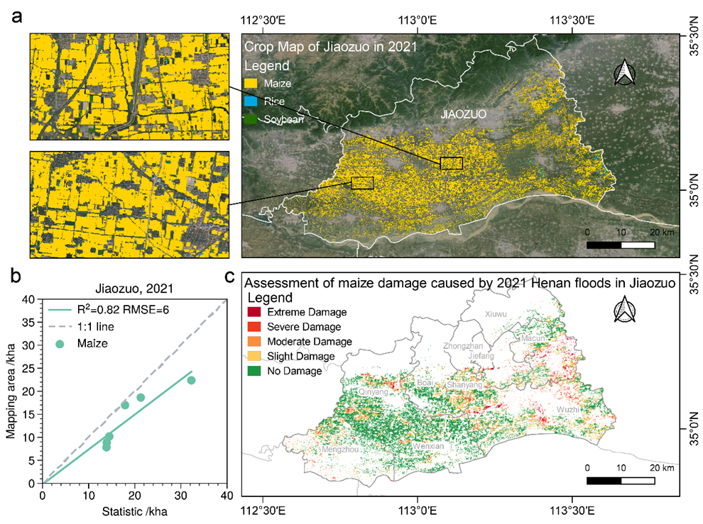
Climate-Adaptive based Cross-Region Crop Damage Assessment基于气候自适应的跨区域农作物损失评估 Using the proposed climate-adaptive cross-region mapping method (R² = 0.82), we rapidly assessed the impact of the 2021 Henan extreme flood on maize in Jiaozuo, Henan Province. The results indicate that the southern and southeastern regions of Jiaozuo suffered the most severe maize damage. 使用...
Details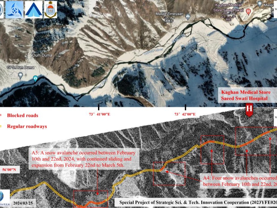
The avalanche incident occurred in Naran, northern Pakistan on March 21, 2024, which submerged houses and hotels, served as a trigger for further in-depth analysis of avalanche risks in the downstream towns and villages. Through comprehensive multi-case studies, it was found that the phenomenon of snow melting into water before heavy precipitation warrants particular vigilance, as it greatly in...
Details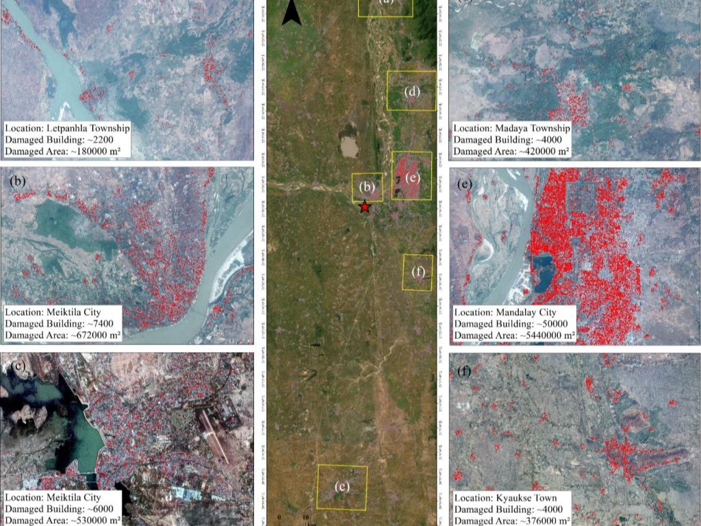
Leveraging GF-1B high-resolution satellite imagery (2-meter resolution) provided by the Land Satellite Remote Sensing ApplicationCenter,Ministry of Natural Resources of China, our team conducted a comprehensive damage assessment of buildings impacted by the March 28 Myanmar earthquake. The data revealed severe structural losses, with Mandalay Citysufferingthe most extensive damage—50,000 build...
Details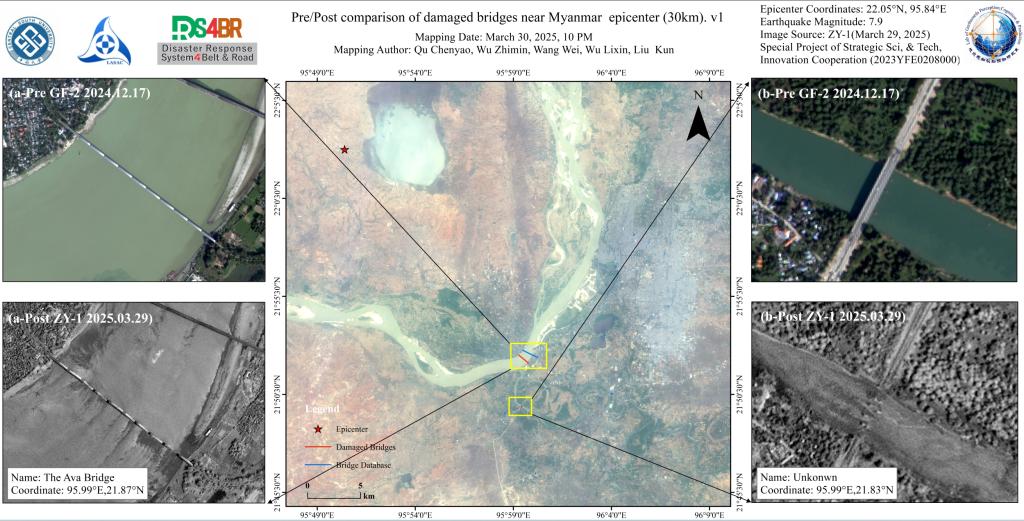
Utilizing ZY-1 high-resolution imagery (2- meter resolution) provided by the Land Satellite Remote Sensing Application Center, Ministry of Natural Resources of China, combined with advanced deep learning-based small target recognition algorithms, our team automated damage detection across bridge networks. Partial collapse of a kilometer-scale bridge (The Ava Bridge, coordinates 21.87° N, 95.99°...
Details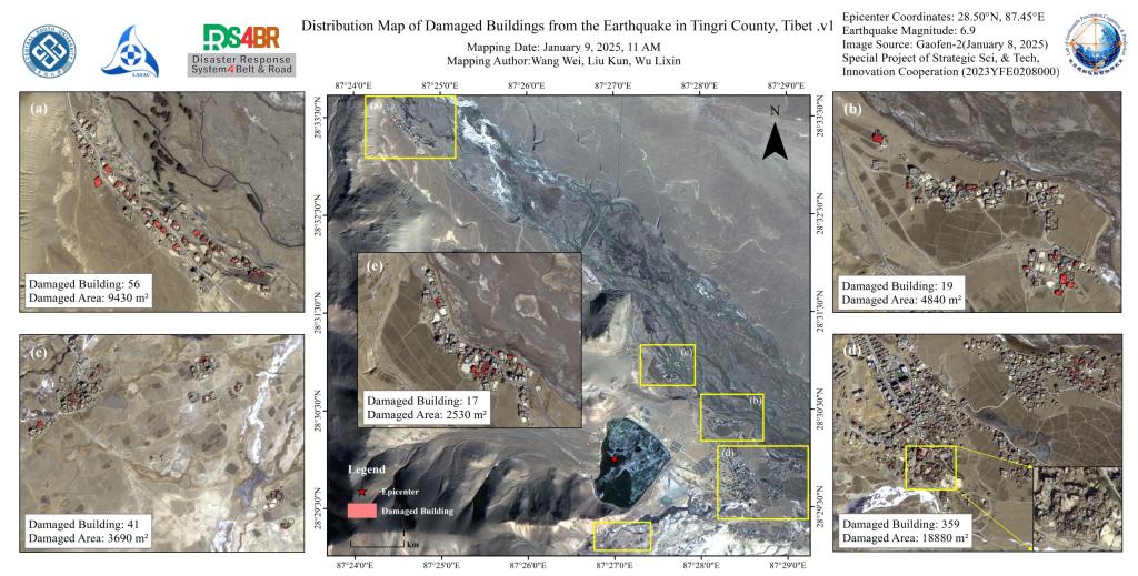
According to the China Earthquake Networks Center, at 09:05 on January 7, 2025, an M6.8 earthquake occurred in Dingri County, Shigatse City, Tibet Autonomous Region. The focal depth was 10 kilometers, and the epicenter was located at 28.50 degrees north latitude and 87.45 degrees east longitude. On January 9, the joint scientific research team of Central South University and the National Satell...
DetailsCopyright © 2025. DRS4BR All rights reserved.